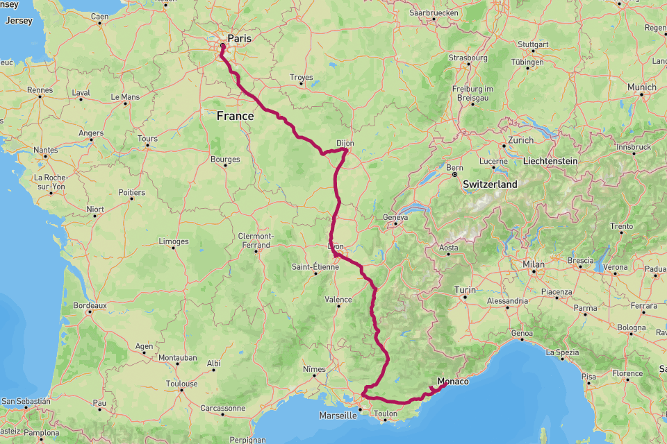
Nice → Paris Motorcycle Route.
Mediterranean to the capital — 932 km up the spine of France by motorcycle.
// The story
From the palm-lined Promenade des Anglais to the Périphérique, the run from Nice to Paris climbs out of the Mediterranean light, over the foothills of the Alps and the Massif Central, through the vineyards of Burgundy and up the long valleys toward the capital — 932 kilometres of changing country best taken slowly, on two wheels. RouteToWall turns your motorcycle GPS into a tall editorial poster — the whole south-to-north line in a single frame, optional overnight markers, and the elevation telling the story of the land rising and falling beneath you.
// How to make this poster
Four steps from your GPS to a print-ready poster.
- Step 01
Import your route
Upload a GPX file, or connect Strava and pick the activity. RouteToWall also reads Google Maps exports.
- Step 02
Choose a template
Pick from minimalist, topographic, panoramic and editorial templates tuned for road, trail, city and roadtrip.
- Step 03
Customize
Set colours, typography, titles and stats, and annotate cols, refuges or landmarks.
- Step 04
Export or print
Download a high-resolution file, or order a museum-grade print up to A1, shipped to your door.
// Templates
Three handpicked templates, ready for your GPX.
// Frequently asked
Q.01Best orientation for a long point-to-point?
Vertical. Nice to Paris runs roughly south to north, so a portrait A2 carries the full line with room for the stats.