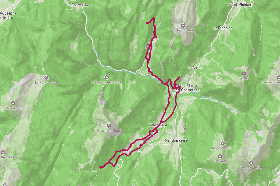
Chartreuse Massif.
A 28 km loop through the limestone cloister of the Pre-Alps.
// The story
The Chartreuse is the quiet massif between Grenoble and Chambéry — limestone walls, beech forest, alpine meadows, and the Carthusian monastery that gave the range and the green liqueur their name. A 28-kilometre loop with 1,820 metres of climbing links the balconies and cols of the Réserve Naturelle des Hauts de Chartreuse, with Chamechaude and the Dent de Crolles watching over the route. RouteToWall turns your hike's GPS into a topographic vector poster — the loop drawn over the contour lines, the elevation profile below, and the day's numbers in the margin.
// How to make this poster
Four steps from your GPS to a print-ready poster.
- Step 01
Import your route
Upload a GPX file, or connect Strava and pick the activity. RouteToWall also reads Google Maps exports.
- Step 02
Choose a template
Pick from minimalist, topographic, panoramic and editorial templates tuned for road, trail, city and roadtrip.
- Step 03
Customize
Set colours, typography, titles and stats, and annotate cols, refuges or landmarks.
- Step 04
Export or print
Download a high-resolution file, or order a museum-grade print up to A1, shipped to your door.
// Templates
Three handpicked templates, ready for your GPX.
// Frequently asked
Q.01Does the topographic style suit a hike?
Perfectly — the topo template draws your loop over contour lines, which reads beautifully for a mountain massif like the Chartreuse.