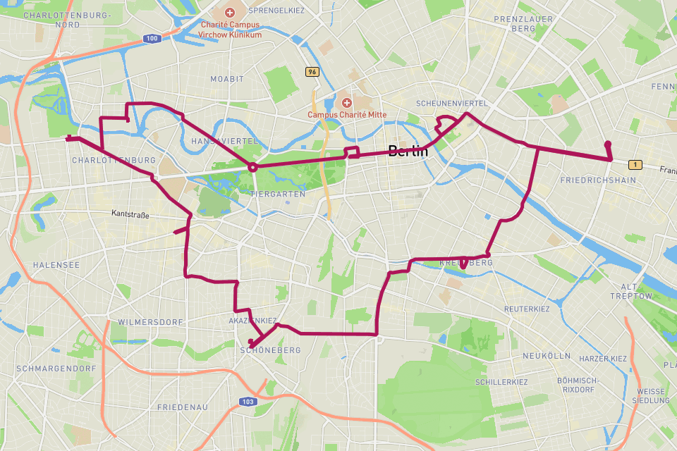
Berlin Marathon.
The fastest marathon on Earth — 42.2 km to the Brandenburg Gate.
// The story
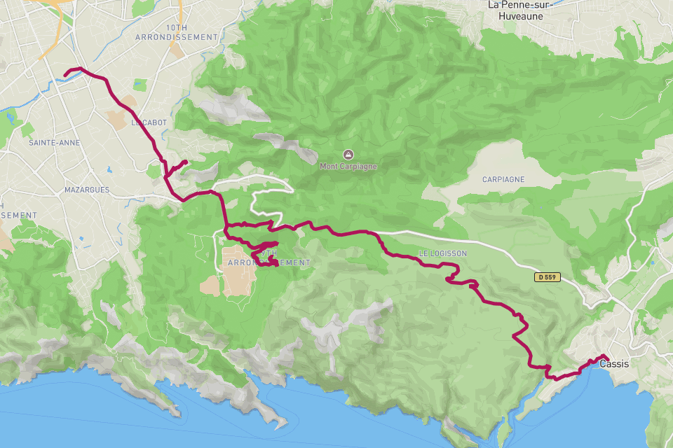
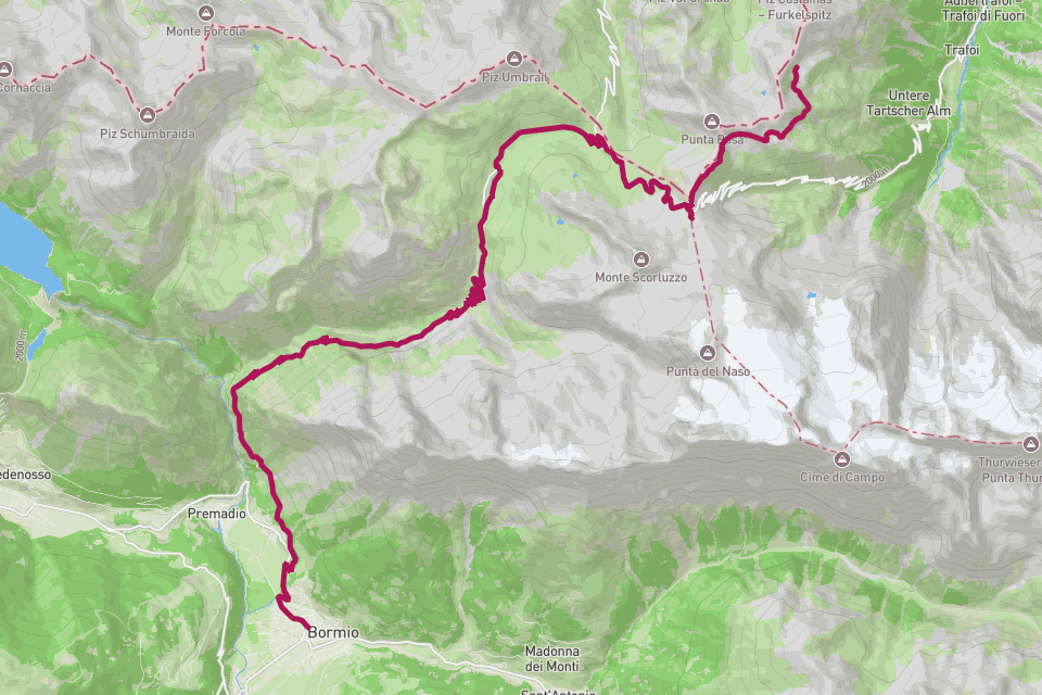
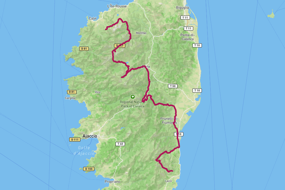
Berlin is where marathon world records go to fall — a flat, fast, wide course through a city that runs straight and true. The route loops past the Reichstag, the TV Tower, Potsdamer Platz and Charlottenburg before the final straight down Unter den Linden and through the Brandenburg Gate, one of the most iconic finishes in running. Eight of the last world records were set here. RouteToWall turns your Berlin GPS into a minimalist city poster — your line over the Berlin grid, the Gate at the finish, distance and time in the margin.
// How to make this poster
Four steps from your GPS to a print-ready poster.
- Step 01
Import your route
Upload a GPX file, or connect Strava and pick the activity. RouteToWall also reads Google Maps exports.
- Step 02
Choose a template
Pick from minimalist, topographic, panoramic and editorial templates tuned for road, trail, city and roadtrip.
- Step 03
Customize
Set colours, typography, titles and stats, and annotate cols, refuges or landmarks.
- Step 04
Export or print
Download a high-resolution file, or order a museum-grade print up to A1, shipped to your door.
// Templates
Three handpicked templates, ready for your GPX.
// Frequently asked
Q.01Will my exact splits show?
The poster shows your distance and finish time by default; per-kilometre splits can be added as margin annotations if your GPX carries timestamps.