Marseille-Cassis.
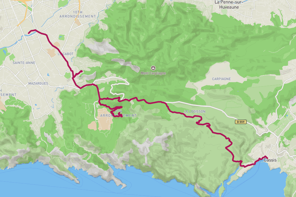
Stade Vélodrome to the Cassis seafront — 20 km over the Col de la Gineste.
// The story
Marseille-Cassis — the Classique Internationale — is one of the great mass races of southern France. From the Stade Vélodrome the road climbs steadily for ten kilometres up the Col de la Gineste at 327 metres, through the white limestone of the Calanques, before a fast plunge down to the harbour at Cassis. Every October some twenty thousand runners trace the same line under the Provençal sun. RouteToWall turns your GPS into a clean vector poster — the full point-to-point line, the Gineste climb in the elevation profile, and your time in the margin.
// How to make this poster
Four steps from your GPS to a print-ready poster.
- Step 01
Import your route
Upload a GPX file, or connect Strava and pick the activity. RouteToWall also reads Google Maps exports.
- Step 02
Choose a template
Pick from minimalist, topographic, panoramic and editorial templates tuned for road, trail, city and roadtrip.
- Step 03
Customize
Set colours, typography, titles and stats, and annotate cols, refuges or landmarks.
- Step 04
Export or print
Download a high-resolution file, or order a museum-grade print up to A1, shipped to your door.
// Templates
Three handpicked templates, ready for your GPX.
// Frequently asked
Q.01Will the Col de la Gineste show on the profile?
Yes — the long climb to 327 m and the drop into Cassis are the defining shape of the elevation strip.
Q.02Best orientation for this course?
Either works. The route runs roughly east, so a landscape format carries the Vélodrome-to-Cassis line cleanly.