GR20.
Corsica north to south — 180 km of the hardest GR trail in Europe.
// The story
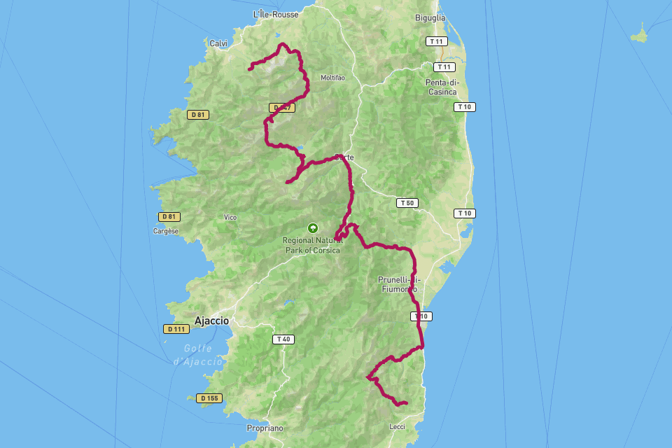
The GR20 runs the granite spine of Corsica from Calenzana in the north to Conca in the south — roughly 180 kilometres with 11,000 metres of climbing, and a reputation as the hardest waymarked trail in Europe. Sixteen stages of scrambling over slabs, ridgelines, scree, and the famous Cirque de la Solitude terrain, with refuges spaced a hard day apart. Most hikers take fifteen days; the fell-running record is under 32 hours. RouteToWall merges the GPS of your whole traverse into one editorial poster — the full north-south line, refuge markers, and the brutal elevation profile that explains the aching legs.
// How to make this poster
Four steps from your GPS to a print-ready poster.
- Step 01
Import your route
Upload a GPX file, or connect Strava and pick the activity. RouteToWall also reads Google Maps exports.
- Step 02
Choose a template
Pick from minimalist, topographic, panoramic and editorial templates tuned for road, trail, city and roadtrip.
- Step 03
Customize
Set colours, typography, titles and stats, and annotate cols, refuges or landmarks.
- Step 04
Export or print
Download a high-resolution file, or order a museum-grade print up to A1, shipped to your door.
// Templates
Three handpicked templates, ready for your GPX.
// Frequently asked
Q.01North-to-south or south-to-north?
Either — your poster follows the direction you walked. Most do Calenzana → Conca (north to south), which is how the trace renders by default.
Q.02Can I mark the refuges?
Yes. Any waypoint along the trace — Tighjettu, Petra Piana, Usciolu — can become an annotated marker.