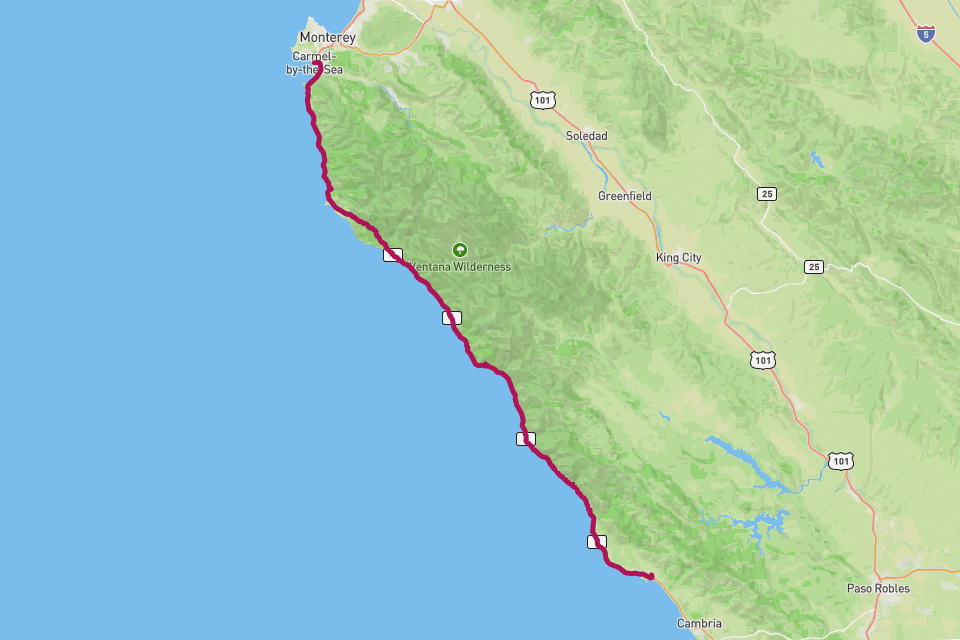
Highway 1 — Big Sur.
California State Route 1 — the cliff-edge ocean road through Big Sur.
// The story
California State Route 1 — Highway 1 — threads the cliff-edge between the Santa Lucia Mountains and the Pacific, and the Big Sur stretch from San Simeon up to Carmel is its most cinematic span. Bixby Bridge, McWay Falls, Hearst Castle, sea otters in the kelp, and fog pouring over the ridgeline: it is the most filmed road in America for a reason. RouteToWall turns your GPS drive into a wide panoramic poster — the long horizontal line of the coast in a single frame, optional viewpoint pins, and the Pacific to one side the whole way.
// How to make this poster
Four steps from your GPS to a print-ready poster.
- Step 01
Import your route
Upload a GPX file, or connect Strava and pick the activity. RouteToWall also reads Google Maps exports.
- Step 02
Choose a template
Pick from minimalist, topographic, panoramic and editorial templates tuned for road, trail, city and roadtrip.
- Step 03
Customize
Set colours, typography, titles and stats, and annotate cols, refuges or landmarks.
- Step 04
Export or print
Download a high-resolution file, or order a museum-grade print up to A1, shipped to your door.
// Templates
Three handpicked templates, ready for your GPX.
// Frequently asked
Q.01Best orientation for a coast road?
Panoramic. Highway 1 is long and horizontal — the 1000 × 400 mm pano format renders the full coastline beautifully.
Q.02Can I add Bixby Bridge as a landmark?
Yes — any waypoint along the drive can become an annotation pin, Bixby Bridge included.