Tokyo Marathon.
42.2 km through the heart of Tokyo — Shinjuku to the finish by the bay.
// The story
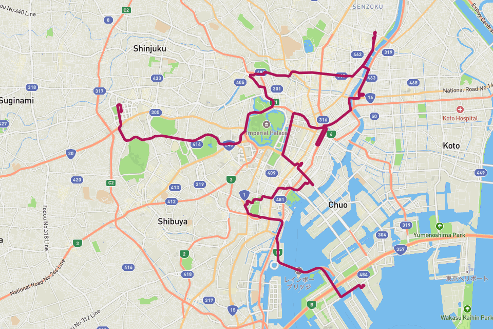
A run through Tokyo is a run through contrasts: the neon canyons of Shinjuku, the temple gates of Asakusa, the Imperial Palace moat, and the long straight of Ginza, before the course bends toward Tokyo Bay. The Tokyo Marathon is one of the six World Marathon Majors and the loop captures the city's scale better than any photo. RouteToWall turns your GPS into a minimalist city poster — the route as a single confident line over the grid of Tokyo, distance and finish time set in the margin, ready for the wall.
// How to make this poster
Four steps from your GPS to a print-ready poster.
- Step 01
Import your route
Upload a GPX file, or connect Strava and pick the activity. RouteToWall also reads Google Maps exports.
- Step 02
Choose a template
Pick from minimalist, topographic, panoramic and editorial templates tuned for road, trail, city and roadtrip.
- Step 03
Customize
Set colours, typography, titles and stats, and annotate cols, refuges or landmarks.
- Step 04
Export or print
Download a high-resolution file, or order a museum-grade print up to A1, shipped to your door.
// Templates
Three handpicked templates, ready for your GPX.
// Frequently asked
Q.01Does it work for any Tokyo run, not just the marathon?
Yes — upload any Tokyo GPX, from a 5 km park loop to the full Major, and the city poster renders your exact line.